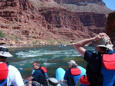
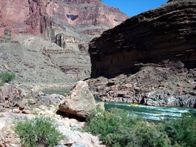
The leader of the expedition, Major John Wesley Powell, was a soldier, scientist and adventurer. He had lost one arm at the Battle of Shiloh in the Civil War but that barely slowed him. He thirsted to discover the unknown. His men were of the same mind and entered the canyon with anticipation, not dread.

Just over three weeks later, six members of the party reached the Mormon settlement on the Virgin River near Grand Wash, the terminus of the Grand Canyon. They had been given up for dead and the settlers could hardly recognize the sunburned, starving men who floated out of the canyon in their battered boats. Three men had lost hope only the day before and left the party at Separation Rapid to strike out overland. Those men made the climb out of the canyon but were probably killed shortly thereafter by Shivwit Indians who mistook them for white men who had attacked them. But John Wesley Powell had reached his goal and returned east to a hero's welcome.

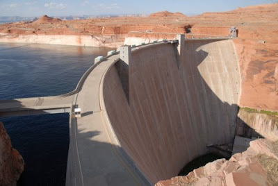
The river that Powell and his men descended does not exist any more. The Glen Canyon Dam, built in the 1960's produces electricity for the region and formed Lake Powell. The Spanish named the river "Colorado" because it was "colored" red by the silt from its many tributaries. That silt now settles to the bottom of Lake Powell and the river runs clear, and cold. Water below the dam comes from the bottom of the lake at 50 degrees.

Two things however, haven't changed, the spectacular scenery, like Horseshoe Bend at sunset, just below the dam, and the seemingly unending rapids that occur throughout the descent.

We set out to experience both, the stark beauty of the canyon and the whitewater. Our group was made up of eight members of the Utah Angels, the investment group I belong to, and our sons and friends, 25 in total, plus 4 guides. We would cover 188 miles of the 240 in the Grand Canyon.

At the put-in at Lee's Ferry we participated in the Hokey-Pokey ritual that one of our members does by tradition before every adventure trip.

Then we loaded our gear on two large rafts, donned rain gear for the rapids, and headed down river.

The rafts are large J-rig rubber rafts, specially designed for this river and powered by a small outboard motor. All the gear is lashed amidship. Seating is along the side and front of the gear. But for the real fun there are nine positions out front on the pontoons with only ropes to hang on to.

Much of the river was calm, and the scenery was amazing,

but then we would begin to hear a low roar that would grow as we approached another set of rapids. At almost every rapid we thought of Powell and his men hearing the same roar and not knowing what they faced around the bend. [These next three picture are from our outfitter since I don't have a waterproof camera.]

Of course, today all the rapids are well known and have been named. One way to immortality is to drown, or come close to it, in a rapid because then it gets named for you. Willie's Necktie is named for Wilson "Willie" Taylor who went overboard in the rapid and came up with a boat rope wrapped around his neck. He was pulled through the rapid by the neck and lived to tell the story. Other rapids are named for their features; House Rock, Lava Falls. My favorite is Sockdolager, old English for "knockout blow."

The J-rig is built for the big rapids, and after assessing our appetite for adventure, the guide drove straight into the roughest sections.

In some sections, riding the rapids is like getting hit with a firehose every 5-10 minutes. But you dry off quickly in the heat and start looking forward to the next one.

In the afternoon we would pull over on a narrow, sandy beach and set up camp. The weather was perfect so we laid out sleeping bags on top of cots and most nights slept under just a sheet.

After setting up camp we would wash off with a quick dunk in the river then do a little exploring.

We were called to dinner with an old bugle. The food was fantastic. Hearty dinners included steak, trout, one night was mexican. On the fourth night we had ice cream that had been packed in dry ice (just to show off, I think.) Breakfasts were pancakes, eggs and sausage and always more than we could eat.

Each day we would stop at scenic points. Vasey's Paradise is a large spring bursting from the cliff wall.

Redwall Cavern is a huge cave scoured out by the river. The entire Utah Symphony played here one evening.

It's large enough for a frisbee football game with room to spare.

Another day we pulled over at the mouth of the Little Colorado and hiked up this tributary.

The water is turquoise from calcium carbonate in the surrounding rock.

The warm water is beautiful, and inviting,

and we soon joined the others riding the rapids.

Here's Berton, surfing the pipeline.

We wore our lifejackets around our waists for flotation, and for a fashion statement.

Another day we tied up to some rocks and made a steep climb above the boats.

Then we followed the small stream up the canyon,

to this double water fall.


But we always returned to the river with more rapids to run.

On another hike we found this hidden grotto,

complete with diving platform and swimming pool.

Deer Creek Falls is the largest along the river.

We climbed to the top and then hiked back behind it,

to another falls spouting from the rock.

We spent a whole morning on the Havasu, another beautiful river of turquoise water.

This is scenery unparalleled anywhere in the world.

On our last night the guides sprung one last surprise, "room service" shrimp cocktail.

The next morning we pulled in at the Whitlock helipad. Two helicopters shuttled passengers down who were beginning their trip, and then shuttled us up to a nice warm shower, a final lunch, and then a plane flight back to our starting point.


